TJ Homeschooling: Social Studies-Geography

Showing posts with label Social Studies-Geography. Show all posts

50 States Progress Trackers

Our 50 States memorization work is coming along nicely, alhamdulillah. My 7th grades is working her way through memorizing the 50 state names, capitals, and postal abbreviations, as I mentioned in my 10 Ways to Learn the 50 States post.

Our State Study Mastery Goals:

  • Correctly identify a given state on a blank outline map (and/or on state shape flashcards)
  • For a given state, give its capital
  • For a given state, spell its capital
  • For a given state, give its two letter postal abbreviation
  • For a given capital, give its corresponding state
  • For a given capital, spell its corresponding state

My daughter studies them on her own each day with the help of the free Sheppard Software and then later on in the day I quiz her. Besides quizzing her on where each state is, I also give her dictation to help with the spelling and capitalization rules and that has helped greatly because she is more conscious of correctly capitalizing the capital names than she was before we started.

To help keep on track, we've done a few things to track her progress:


  • Progress map - as she learns the state name and it's location, capital name, and postal abbreviation, she colors in the state on a blank outline map (in this case, she studies them by region so she colors in regions as she masters them--3 more regions to go, woo-hoo!):

  • 50 States Progress Tracker - I created this so that not only does it act as a tracker, but also a reference chart should she need it.  As she learns a state, she records the capital name and its postal abbreviation. When she has mastered each of these pieces of information, she can check it off on the tracker:
50 States Progress Tracker

It also acts as an aid for me when I am quizzing her so that I don't have to sit there and think up a state name and capital off the cuff.

Maintaining the Knowledge

Once/as the states have been memorized, it will be important to keep reviewing them on a regular basis to commit them to long term memory.  So, I'm borrowing a review system idea that I have seen used for things like memorizing scripture.

Basically, once a fact is known, review it:
  • Daily for five days
  • Then, choose an odd or even day and review the fact for a whole week on odd or even days
  • Next, choose a day of the week, say Sunday, and every Sunday for a month, review that fact
  • Finally, choose a day of the month (say the 26th) and on the 26th of each month review that fact.  
Since we are studying states by the region, I would keep them chunked together and review the capital name, state name, location on a map and postal abbreviation on assigned days.

You can make the review system easier to follow by using index cards with tabbed dividers marked (daily, odd, even, one for every day of the week, and then 1-31 tabs). Then, you would simply make a card for each state and move the card to the appropriate tabbed section).


 photo yellow-ruler_zpstf30f6qm.png

Round Up of Some of My Favorite US Geography Resources

Here is a quick round up of some of my tried and true US Geography resources over the years....


Games

Sheppard Software Online Games – learn the states, capitals, and geographical regions.


imageAnimated States and Capitals (downloadable game) – “Learn the U.S. states and capitals. A full screen clickable map of the U.S. is used to teach names and locations of states and capitals in a variety of ways. When the student completes ten problems they are rewarding with a silly animation using 3D graphics.” Heads up: Now this is pretty old school so it may not work on newer computers, this has been around for some time.


SeterraSeterra (downloadable game) – “Seterra is a geography program with 70 different exercises. With Seterra you will be able to learn about countries, capitals, flags and cities You can test and improve your knowledge of world cities, capital cities, countries, geographical features, and flags.”


Flashcards

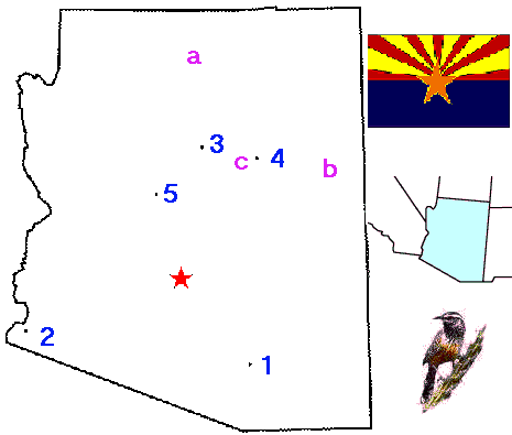
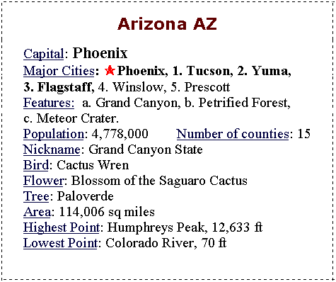
US States Flashcards – some of the best I have seen; packed with information. On one side is the shape, flag, bird, and mini regional map of where the state is. On the back, there's oodles of facts, such as the capital, nickname, size, etc..


US States/Capital Flashcards from Teacher Vision


United States and Capitals Flash Cards


Maps


Worksheets


Reference


New World Map Showing South Sudan (from 2011)

New World Map (2011) Showing New Country of South Sudan
From 2011:


New World Map Showing South Sudan

My oldest daughter and I enjoy reading maps and geography books together and were noting that our maps would not show the new country of South Sudan. So, I went searching for a new world map that showed South Sudan. I found this colorful one at Guardian.co.uk and we really enjoyed looking over it as it also contains some interesting facts in the margins such as most populous countries, poorest countries, etc.


 photo yellow-ruler_zpstf30f6qm.png

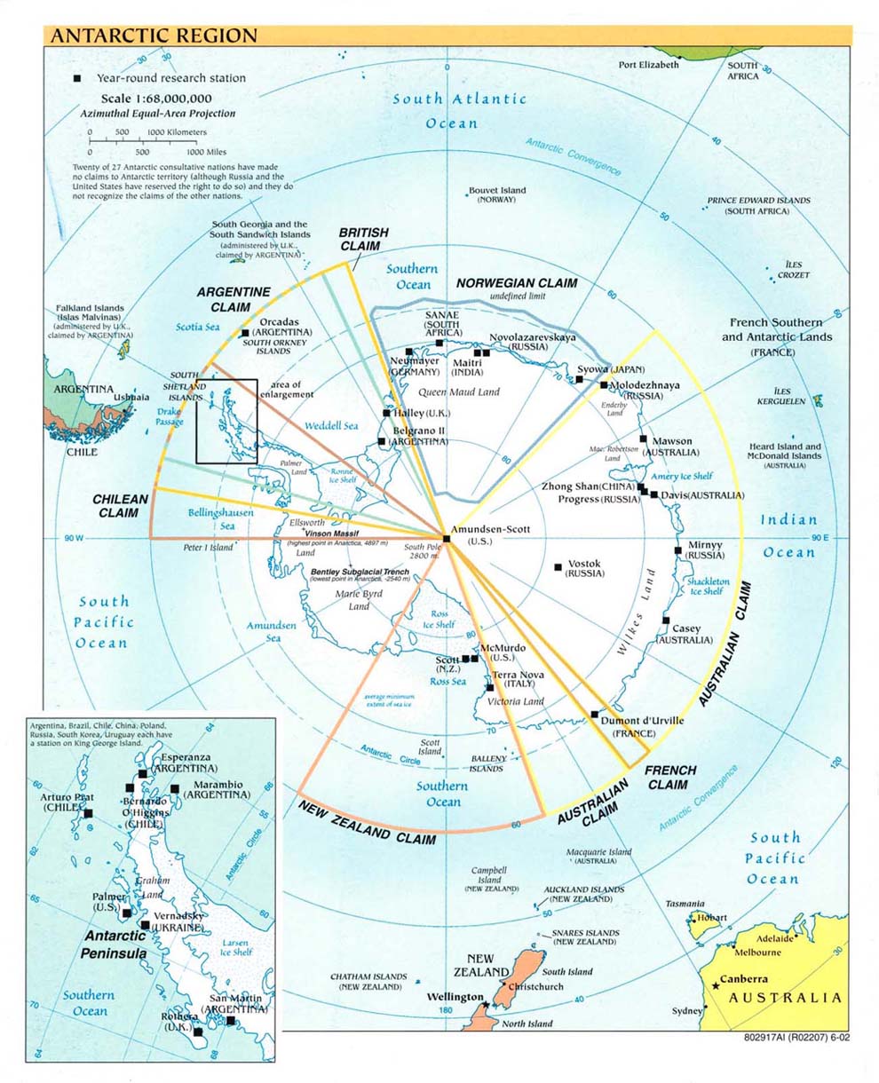
Antarctica Maps

Antarctica Map Resources
As I was collecting maps for our student organizers, I realized that we have never had an Antarctica map so I set out to find one......


The first two are my favorites:


original post date: 10/12/11

 photo yellow-ruler_zpstf30f6qm.png

Neat Resource to Learn the State Postal Abbreviations


Learn the States and Postal Abbreviations


Some time ago, I stumbled across a free 29 page e-book for learning state postal abbreviations.

It includes maps, worksheets and  flashcards to help your student learn the names and locations of states as well as their 2 letter postal abbreviations. It also includes lesson plans for using the materials.


One of the things that I like from this packet is a postal abbreviation study sheet which arranges the states' postal codes by how they are made (first two letters, first and last letters, etc)